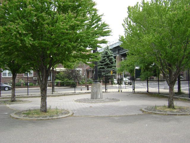
Chappetto-Square
Place Category: Parks and Playgrounds
“The Triborough Bridge is not merely a road for automobiles and trucks, but a general city improvement, reclaiming dead area and providing for residence along its borders, esplanades, play facilities, landscaping and access to great new parks.” -Robert Moses, 1936
This park honors the memory of Peter Chappetto, an Astoria resident who was killed in action during World War II. When Robert Moses (1888-1981) took control of the Triborough Bridge Authority in 1934, he had envisioned a series of parks with play facilities and landscaping surrounding the bridge approaches. This square is just one of the seven that constituted the Triborough Bridge Playgrounds. The remaining six parks and playgrounds on Hoyt Avenue North and Hoyt Avenue South, between 21st and 26th Streets, continue to be known as the Triborough Bridge Playgrounds.
The Triborough Bridge consists of 13,829 feet of roadway viaduct, running over three steel bridges, spanning the waters between Manhattan, the Bronx, and Queens. Plans for connecting the three boroughs were first announced in 1916 by Edward A. Byrne, the chief engineer of the City Department of Plant and Structures. The project, however, did not receive any funding until 1925. Construction of the bridge, designed by Othmar H. Ammann and architect Aymar Embury II, began on October 25, 1929—otherwise known as “Black Monday,” the day of the stock market crash that helped set off the Great Depression. During the ensuing economic crisis, investors refused to purchase unstable municipal bonds and all construction halted as the city found itself without adequate funds. Work on the bridge was at a standstill until 1932, when Robert Moses, serving as chairman of the State Emergency Public Works Commission, made it a top priority.
In early 1933, legislation drafted by Moses formed the Triborough Bridge Authority (TBA). The TBA was intended to be a temporary public-benefit corporation that would pay for the bridge by selling its bonds exclusively to the Reconstruction Finance Corporation, and later, the Public Works Administration, both New Deal organizations set up by President Franklin D. Roosevelt to help rebuild the economy.
On July 11, 1936, after seven years of stilted construction and over $60 million worth of expenses, the Triborough Bridge opened to traffic. The main span carries cars 2,780 feet from Queens to Ward’s Island, 143 feet above the river. A 700-foot lift bridge connects Randalls Island and 125th Street in Manhattan, and a 1,217 foot-long truss bridge links Randalls Island to the Bronx. In addition to its three main elements, the complex structure comprises a number of smaller bridges and viaducts, 14 miles of approach highways and parkways, with parks and recreational facilities inserted wherever possible.
During its first year, the bridge carried 9,650,000 vehicles and generated $2.7 million in tolls. Rather than dismantle the Authority as planned, Robert Moses encouraged the Federal government to allow the TBA to sell bonds to private investors. Under the direction of Robert Moses, the Authority grew steadily, becoming the Triborough Bridge and Tunnel Authority. It is now the MTA Bridges and Tunnels division, and is still headquartered on Randalls Island. In 1999, 61,929,000 vehicles traveled across the Triborough Bridge, generating over $217 million in tolls. A major, multi-year, $600 million project to rebuild the bridge and its ramps is expected to begin in the first decade of the 21st century.
The City of New York acquired this land in 1931 for construction of the bridge. Six years later, with the bridge completed, the Authority surrendered the land to Parks. The parkland was renamed Chappetto Square in 1947. The park contains a hockey rink and three trees that surround the flagpole and memorial plaque. Friends and family attended the 1949 dedication of the bronze and cast stone flagstaff, which memorializes Chappetto and all those who died in World War II.
- Chappetto square
New York
New York
11102
United States No Records Found
Sorry, no records were found. Please adjust your search criteria and try again.
Google Map Not Loaded
Sorry, unable to load Google Maps API.
-

