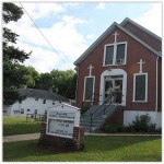
 Rossville is a neighborhood of Staten Island, New York, on the island’s South Shore.
It is located to the north of Woodrow, to the west of Arden Heights, and to the south and east of the Arthur Kill.
HISTORY
Early history
Originally inhabited by the Raritan Indians, the area that eventually became known as Rossville remained largely free of European settlers until 1684 when the first land survey of the area was made by the British, who obtained Staten Island from the Dutch in the Treaty of Breda, which ended the Second Anglo-Dutch War.
In 1692, Daniel Perrin, a Huguenot originally from Jersey, was granted 80 acres (320,000 m2) of land in the area (then known as Smoking Point) by GovernorBenjamin Fletcher.
During the mid 18th century, the area was known as Old Blazing Star, and later simply Blazing Star, for a tavern located there. The Blazing Star Burial Ground, an abandoned cemetery dating from the mid-1750s, can be found just off Arthur Kill Road, north of Rossville Avenue (40.5568°N 74.2118°W).
The Blazing Star Ferry, which crossed the Arthur Kill to Woodbridge Township, New Jersey, was established in the years before the American Revolution. When the Richmond Turnpike (known today as Victory Boulevard) was built across Richmond County in 1816, it improved connections to the western parts of the island and to the competing New Blazing Star Ferry in Long Neck (known today as Travis), which had steamboat and stagecoach connections to Philadelphia.
By the 1830s the area was renamed Rossville after Colonel William E. Ross, who had built a replica of Windsor Castle (originally known as Ross Castle, later known as Lyon Castle) on a bluff overlooking the landing of the Blazing Star Ferry.
By the mid 19th century, Rossville was a thriving farm community and the village grew around it. However, when the Staten Island Railroad, which bypassed Rossville, opened in 1860, most Staten Islanders began referring to neighborhoods along its route by the name of the nearest station; hence Rossville became colloquially part of Prince’s Bay.
Poor transportation caused the town’s decline until the completion of the West Shore Expressway in 1976. The resulting residential building boom encouraged long time farmers to sell their land to developers which fueled rapid growth in the area, continuing to this day.
Sandy Ground
After slavery in New York was abolished in 1827, freedmen from all over the state, as well as far away as Maryland and Virginia, settled in the area known since colonial times as Sandy Ground, which was located in the area around what is now the intersection of Bloomingdale and Woodrow Roads in Rossville. These early settlers were skilled in the oyster trade, and brought this knowledge with them to Staten Island. Oyster harvesting was a major business on Staten Island during the 19th century and was mainly conducted on the island’s south shore. The area of Prince’s Bay was the main hub and was within walking distance from Sandy Ground. Sandy Ground also served as an important stop on the Underground Railroad, and is the oldest continuously settled free black community in the United States.
Sandy Ground also was a major stop along the Underground Railroad for slaves escaping from the South. It has been speculated that the aforementioned Capt. Jackson might have ferried slaves across the Kill van Kull between Staten Island and New Jersey aboard the ferry boat he owned and operated. A group of abolitionists also called Staten Island home, many in the Livingston section, and other houses in addition to those in Sandy Ground have been identified as possible stops along the railroad. Among these might have been the large home built for George W. Curtis at the corner of Henderson and Bard Avenues. Curtis, who wrote for and was associate editor of Putnam’s Magazine, as well as Harper’s Weekly, was an orator of national renown on many subjects, including the ending of slavery in the United States of America.
Although remnants of the original settlement still exist, most of the original houses were destroyed in the Rossville Fire of 1963.The Sandy Ground Historical Society, which preserves the history and physical surroundings of the Sandy Ground community and maintains a museum and library, was organized on February 28, 1980, and is located at 1538 Woodrow Road.
The Rossville Fire of 1963
On April 20, 1963, Rossville was the scene of the worst of three devastating brush fires to strike Staten Island; the three fires collectively destroyed more than 100 homes, rendering over 500 persons homeless and causing in excess of $2 million in damage. Rossville’s character would be transformed permanently by the fire as it turned out, for once the Verrazano-Narrows Bridge was opened 19 months later, it and many other Staten Island neighborhoods would witness massive new home construction (with many of the homes in Rossville which had been spared by the fire actually being demolished to make way for new, often larger ones).
Rossville today
Although originally mostly farmland, Rossville has become largely suburban in nature — a fact lamented by its original residents, nearly all of whom have since moved away, in many cases after having been bought out under pressure from aggressive developers who have torn down most of the original homes and replaced them with condominium developments and semi-detached homes.

