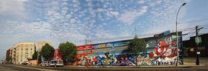
 Hunts Point is a low income neighborhood located on a peninsula in the South Bronx. It is the location of one of the largest food distribution facilities in the world. The neighborhood is part of Bronx Community Board 2. Its boundaries are the Bruckner Expressway to the west and north, the Bronx River to the east, and the East River to the south. Hunts Point Avenue is the primary street through Hunts Point.The neighborhood is served by the NYPD’s 41st Precinct.
As of the United States 2000 Census, Hunts Point has a population of 46,824, up from 39,433 in 1990 and 34,397 in 1980. Of them, 35,507 (75.8%) are of Hispanic origin, 10,021 (21.4%) are Black, non-Hispanic, 582 (1.2%) are White, non-Hispanic, 207 (0.4%) are Asian or Pacific Islander, 101 (0.2%) American Indian or Alaska Native, 90 (0.2%) are some other race (non-Hispanic), and 316 (0.7%) of two or more races (non-Hispanic).
Hunts Point is a low income residential neighborhood. Over half the population lives below the poverty line and receives public assistance (AFDC, Home Relief, Supplemental Security Income, and Medicaid). Hunts Point has one of the highest concentrations of Hispanics in all of New York City.
Only 3,361 people in the area are reported to be in the labor force, which translates as approximately 40% of the total available working population that is employed. The average family here makes around $17,000 per year and the average household income is $16,000 per year. In the United States as whole the average household income is $42,000 per year and the average family makes $50,000 per year.
The ZIP code is 10474.
Europeans first settled Hunts Point in 1663. At this time, Edward Jessup and John Richardson arrived on the peninsula and purchased the land from the Wekkguasegeeck tribe indigenous to the area. After Jessup died his widow, Elizabeth entrusted the land to Thomas Hunt Jr., her son in-law for whom the area is named.
In the years between the Hunts’ inheritance and 1850, several other wealthy landowning families occupied the peninsula. Legend has it that George Fox (1624-1691), founder of the Society of Friends (commonly known as Quakers), preached in the area in 1672. William H. Fox, a descendant of the Quaker leader, and his wife Charlotte Leggett, owned much of the land that is now Hunts Point.
As time passed and more New Yorkers became aware of the luxurious lifestyle available in Hunt’s Point, more City dwellers flocked to the area between 1850 and 1900. Later, the property wound up in the hands of Fox’s and Leggett’s son-in-law, H.D. Tiffany, a member of the family that owned the famous jewelry and decorative arts store Tiffany & Co. now on Fifth Avenue in Manhattan. Fox, Tiffany and Leggett Streets derive their names from these former landowners. In 1909, the Fox mansion was demolished.
Hunts Point’s status as a home and vacation spot to the city’s elite came to a rather abrupt end in the period following World War I. At this time, a train line was built along Southern Boulevard. Apartment buildings replaced mansions, streets replaced meadows and Hunt’s Point became a virtual melting pot for the City’s masses.
